
3D Mapping Across a City
A complete 3D map of 3.7 km of urban streets from a single LiDAR.
TECHNOLOGY
Precise 3D LiDAR mapping and localization for vast, complex spaces where robots, manipulators, and humanoids will work side by side.
Accuracy
Accurate maps start with accurate positioning. Our engine ranks top tier across city streets, campuses, construction sites, and underground tunnels.
A complete 3D map of 3.7 km of urban streets from a single LiDAR.
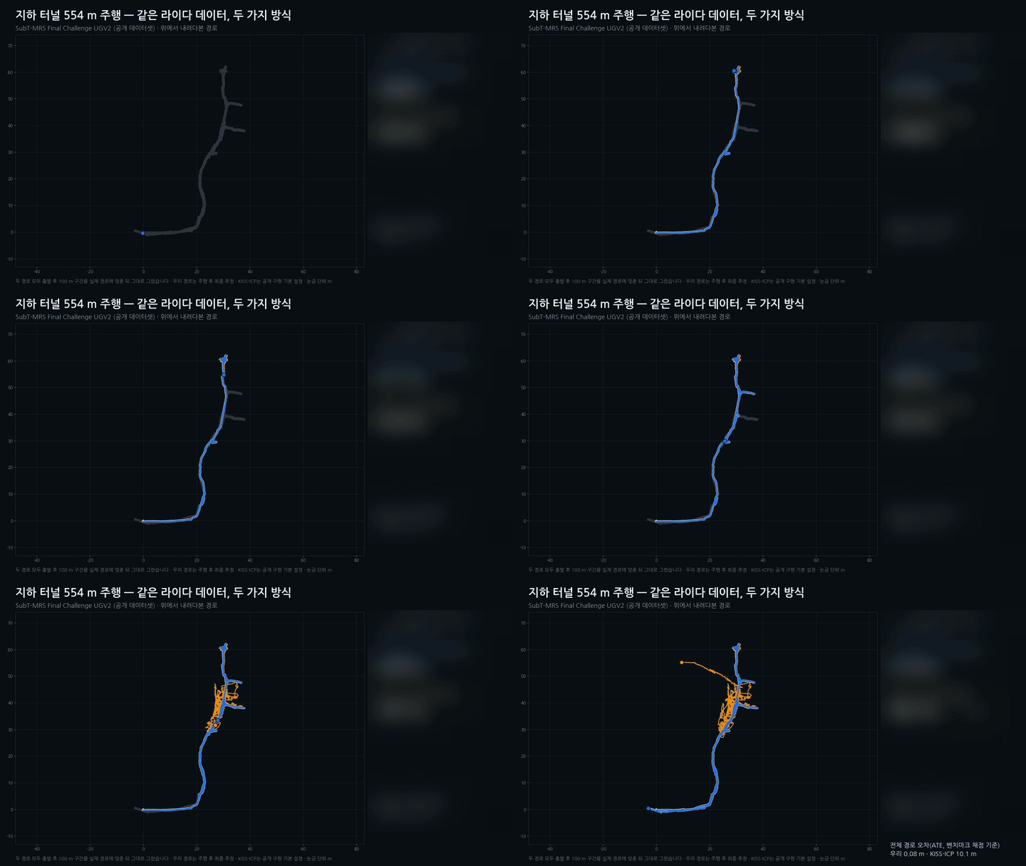
Even underground, our engine stays closely on the true path.
| Benchmark | Environment | Position error |
|---|---|---|
| Hilti 2024 | Construction sites | 0.09 m |
| SubT-MRS 2024 | Underground | 0.29 m |
| NCLT 2016 | Campus | 0.89 m |
| KITTI 2012 | Urban driving | 0.49 % |
Results on public datasets. Position error: RMS absolute trajectory error (ATE); KITTI: relative translation error.
Automation
No need to walk every corner with a scanner. The robot explores on its own and the map completes itself.
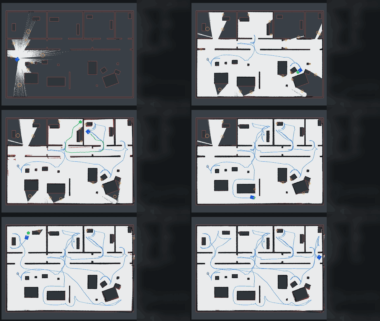
Start it remotely, and the robot explores the space on its own until the map is complete.
When the robot returns to a familiar place, AI recognizes it and keeps large maps consistent.
Localization
Large factories are full of people and identical-looking aisles. Using LiDAR alone, a robot can easily mistake one aisle for another. We combine LiDAR with Wi-Fi signal fingerprints to find the right position, even at semiconductor-FAB scale.
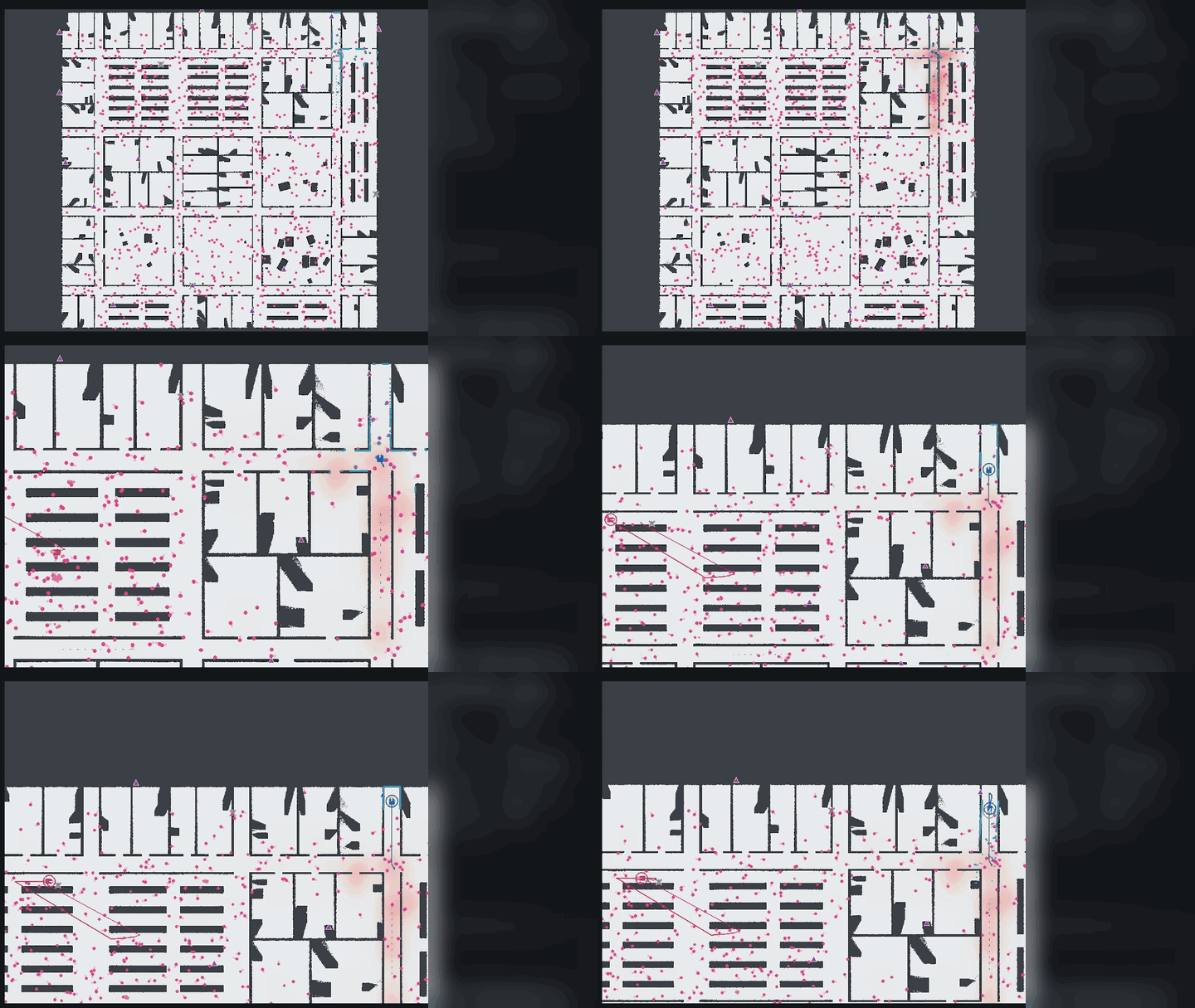
Among hundreds of moving people, the robot using Wi-Fi + LiDAR (blue) finds its true position, while LiDAR only (red) settles on the wrong spot.
Built for sites over 500 m long, about the size of 8 football fields.
Embedded
Our engine is optimized to run in real time on compact embedded hardware inside the robot.
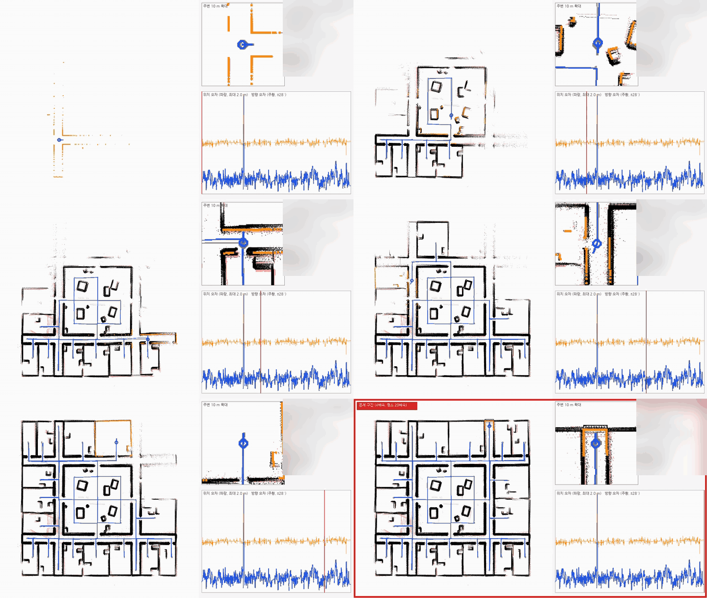
Yes. It is designed for indoor and underground spaces where GPS is unavailable.
It is built for semiconductor-FAB-scale facilities over 500 m long.
No. The robot explores and builds the map on its own.
On an on-premise server at your site.




 동작구청







 우익반도체